

LEVERAGING THE LATEST ESRI SOFTWARE TO PROVIDE QUALITY GIS MAPPING SERVICES


At BlackSheep, our GIS team is built for the oil and gas industry — professionally trained and experienced. We use the latest technology to deliver the right solutions for our clients, every time. You tell us what maps you need, and we will tailor them to your specific requirements.
In business for fifteen years, we have experience in the specialized fields of Oil and Gas, Real Estate Development/Site Suitability, Environmental, and Renewables.
We can tailor our mapping shape files for integration into any client's mapping system. The maps that we create for our clients provide the information you need at your fingertips, enabling you to save time and make more effective decisions. The vital data represented on the map can also be distilled into charts and graphs, which can be powerful visual tools to include in reports and PowerPoint presentations.
Contact us to discuss the specifics, and we will be your reliable GIS team. If you need someone on-site, we can also provide that service.
Let us know what you need.
GIS MAPPING
Parcel Mapping
➡ Parcel mapping involves crafting accurate maps of land parcels, highlighting property lines, ownership details, and key land data. It’s
essential for planning, development, and property evaluation.
Map Digitizing
➡ Map Digitization transforms physical maps into digital versions, making them easier to store, manage, and analyze. It’s essential for
updating old maps and using them within GIS platforms.
Georeferencing
➡ Georeferencing matches spatial data to real-world coordinates, allowing for precise placement. This step is key to combining data layers
and producing reliable geographic maps.
Site Suitability Map
➡ Site Suitability Analysis assesses locations using defined criteria to determine which areas are best suited for development, preservation,
or other planned uses.
Base Map
➡ Parcel mapping involves crafting accurate maps of land parcels, highlighting property lines, ownership details, and key land data. It’s
essential for planning, development, and property evaluation.
Topographical Mapping
➡ Topographical mapping provides in-depth insight into landforms such as slopes, elevations, and natural features. These maps support
effective project planning and frequently use remote sensing to improve detail and accuracy.
Well Permitting Activity and Location
➡ Map the Locations of Proposed, Active, and Historical Wells:
Displays exact surface and bottom-hole locations.
Shows well paths, lateral legs, and directional drilling targets
➡ Track Your Permitting Status:
Displays permit types (e.g., new drill, recompletion, sidetrack).
Flags' current status (e.g., pending, approved, expired, or rejected).
Can be updated in real-time with data from state agencies like the Texas Railroad Commission.
➡ Supports Regulatory Compliance:
Helps ensure wells are permitted correctly based on spacing, offset distances, and lease boundaries.
Identifies conflicts with nearby wells, pipelines, or environmental zones.
➡ Improve Your Planning and Operational Efficiency:
Helps teams prioritize drilling schedules and understand activity trends.
Assists in lease negotiations, unitization, and development planning.
Useful for competitive intelligence—monitoring nearby operators’ activity.
➡ Integrate with Other Datasets:
Links to production data, ownership boundaries, pad sites, roads, and more.
Can be layered with satellite imagery, elevation data, or environmental constraints.
BASINS WORKED


ABOUT

I’m just a guy who’s always had a thing for maps. As a kid, I would spend hours getting lost in them, and eventually, I realized I could turn that passion into a career. In Iraq, where I discovered GIS, I learned how to plot points and create visual data to detect trends for my patrol planning.
Since 2010, I’ve been working as a professional GIS Analyst, primarily in the oil and gas industry, and I’m also a Licensed Texas Realtor.
Over the years, I’ve mapped everything from leaseholds and pipelines to mountain bike trails, horse ranches, and custom unitization maps. If it needs mapping, chances are I’ve done it — or I can.
Before GIS, I served 10 years in the military — first as a U.S. Marine Tanker, then as an Army Military Police Officer.
I believe in being honest, having integrity, and staying on the job til it is done right. Do to others as you would have them do to you (Luke 6:31).
My career has taken me across the country on contract projects, and I still love what I do in this field: combining tech, travel, and creative problem-solving to help people visualize space in a meaningful way.
In my off-GIS time, I manage a 38+ amateur baseball team, cycle competitively, am a runner, take my AR-10 to go shooting, am a father to my son, and let him be a happy kid.

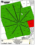
Sample Map Projects


CONTACT
Inquiries
To talk about your project and how we can assist, please call: 817-776-7000 or fill out the following form
Contact Us
LOCATION
Bastrop, TX 78602
Cell 817-776-7000
Employment - 1099's Only
Currently not hiring.
If you wish to be considered as a contractor for any projects that arise. GIS, Title, or Landmen.
Please email us your resume.